Drone Footage: Difference between revisions
Jump to navigation
Jump to search
No edit summary |
|||
| Line 7: | Line 7: | ||
==Orthographic Files== | ==Orthographic Files== | ||
<div> | <div><ul> | ||
<li> | <li style="display: inline-block;">[[File:FullSchoolWebSized.jpg|200px|thumb|left|The Entirety of [[Sage Creek High School]] as of January 28th, [[2018]].]]</li> | ||
<li style="display: inline-block;">[[File:MainBuildingsWebSized.jpg|200px|thumb|left|The main buildings as of January 28th, [[2018]].]]</li> | |||
</li> | <li style="display: inline-block;">[[File:FieldWebSized.jpg|200px|thumb|left|The field as of January 28th, [[2018]].]]</li> | ||
<li> | </ul></div> | ||
</li> | |||
<li> | |||
</li> | |||
</div> | |||
[[Category:Resource]] | [[Category:Resource]] | ||
Revision as of 07:30, 8 November 2018
About
All drone footage was taken by Joey Babcock, for legal use outside of sage creek, visit My Website.
These files are either raw images from my DJI Phantom 3 Standard or orthographic images generated from the same drone and processed in PrecisionMapper.
Orthographic Files
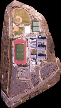
The Entirety of Sage Creek High School as of January 28th, 2018. 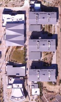
The main buildings as of January 28th, 2018. 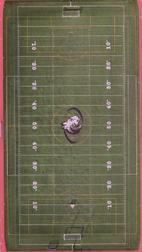
The field as of January 28th, 2018.


